MyLand Abu Dhabi: A Comprehensive Geospatial Platform for Easy Navigation
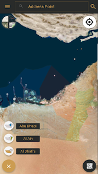
MyLand Abu Dhabi is a geospatial platform developed by the Department of Municipalities and Transport, catering to the three municipalities of Abu Dhabi, Al Ain, and Al Dhafra. Available for Android devices, this free application offers a unified and user-friendly experience for accessing various DMP GIS services.
One of the key features of MyLand is the inclusion of DMP public applications like Onwani, Site plan, and Development Code. With Onwani, users can easily locate address points, street names, districts, and QR code locations. The Siteplan module provides information related to plots and land, allowing users to scan QR codes from the Abu Dhabi Land Management system to view plot details within the MyLand application. Users can search for plot information across the three municipalities using zone, sector, road, and plot numbers. Additionally, MyLand offers GIS overlays such as building development codes and administrative boundaries.
Furthermore, MyLand provides valuable information about allocated land for community facilities and their built-up conditions. Users can also find the locations of licensed community facilities through the application. With its comprehensive range of features, MyLand Abu Dhabi is an essential tool for easy navigation and accessing crucial geospatial information in the region.